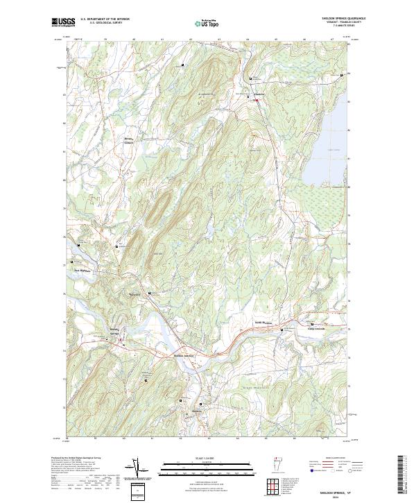
2024 Map of Sheldon Springs
USGS Topo · Published 2024About this map
The Missisquoi River serves as the central artery for this part of Franklin County, winding past several small settlements and industrial-tinged hamlets. In Sheldon Springs, the landscape is shaped by the river's path, while to the east, the Missisquoi Valley Rail-Trl traces the path of former rail commerce through Sheldon Junction and North Sheldon. This area is particularly dense with small family and community burial grounds, such as the Sheldon Home Association Cem and North Sheldon - Fish Cem, which offer significant value for genealogists tracing local lineage.
Find a feature on this map
77 named features on this map. Tap any name to fly to it.
Don’t see what you’re looking for? This feature index may not catch every label — zoom into the map to look around manually.
Map Details
Editions of this 2024 Sheldon Springs Map
This is the sole edition of this map. No revisions or reprints were ever made.
Other maps of this area

1914 · St. Albans
USGS Topo · 1:48,000

1916 · St. Albans
USGS Topo · 1:62,500

1920 · Franklin Pond
USGS Topo · 1:62,500

1922 · Enosburg Falls
USGS Topo · 1:48,000

1924 · Enosburg Falls
USGS Topo · 1:62,500

1943 · St. Albans
USGS Topo · 1:62,500

1944 · Enosburg Falls
USGS Topo · 1:62,500

1950 · Lake Champlain
USGS Topo · 1:250,000
1953 · Enosburg Falls
USGS Topo · 1:62,500

1958 · Lake Champlain
USGS Topo · 1:250,000