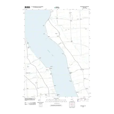
2010 Map of Sheldrake
USGS Topo · Published 2010About this map
Cayuga Lake dominates this landscape, serving as the central divide between the agricultural and viticultural lands of Seneca and Cayuga counties. The eastern and western shores are characterized by numerous points and landings, including Sheldrake Point and Stony Point, where small settlements and shoreline access points like Kidders and Interlaken Beach have long served the lakeside community. The local economy is visibly shaped by the Finger Lakes climate, with extensive viticulture appearing through Sheldrake Point Winery, Cayuga Ridge Estate Winery, and Lucas Vineyards And Winery. Inland, the terrain is marked by deep cuts such as Beard Gully and Carter Gully, while genealogy interests are supported by clearly marked burial grounds like the Quaker Cemetery and Mosher Cemetery. Small hamlets and crossroads, such as Aurora and King Ferry Station, anchor the rural road network connecting these upland farms to the water.
Find a feature on this map
83 named features on this map. Tap any name to fly to it.
Don’t see what you’re looking for? This feature index may not catch every label — zoom into the map to look around manually.
Map Details
Editions of this 2010 Sheldrake Map
This is the sole edition of this map. No revisions or reprints were ever made.
Other maps of this area

1899 · Auburn
USGS Topo · 1:62,500

1902 · Geneva
USGS Topo · 1:62,500

1902 · Genoa
USGS Topo · 1:62,500

1902 · Ovid
USGS Topo · 1:62,500

1902 · Auburn
USGS Topo · 1:62,500

1942 · Ovid
USGS Topo · 1:31,680

1942 · Ludlowville
USGS Topo · 1:24,000

1942 · Lodi
USGS Topo · 1:24,000

1942 · Sheldrake
USGS Topo · 1:24,000

1942 · Genoa
USGS Topo · 1:24,000