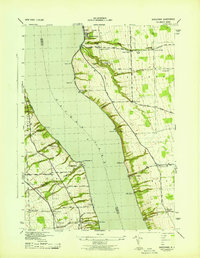
1943 Map of Sheldrake
USGS Topo · Published 1943About this map
Wells College dominates the northern shoreline of Cayuga Lake in this mid-century survey, situated at the edge of the historic village of Aurora. The landscape is defined by the steep gullies and waterfalls common to the Finger Lakes region, including Moonshine Falls and Oak Tree Falls, which cut through the uplifted terrain toward the lakefront. Significant transportation infrastructure of the era is evident along both shores, most notably the Lehigh Valley Railroad corridor which services remote points like Willets and Kings Ferry Station.
Find a feature on this map
54 named features on this map. Tap any name to fly to it.
Don’t see what you’re looking for? This feature index may not catch every label — zoom into the map to look around manually.
Map Details
Editions of this 1943 Sheldrake Map
This is the sole edition of this map. No revisions or reprints were ever made.
Other maps of this area

1899 · Auburn
USGS Topo · 1:62,500

1902 · Geneva
USGS Topo · 1:62,500

1902 · Genoa
USGS Topo · 1:62,500

1902 · Ovid
USGS Topo · 1:62,500

1902 · Auburn
USGS Topo · 1:62,500

1942 · Ovid
USGS Topo · 1:31,680

1942 · Ludlowville
USGS Topo · 1:24,000

1942 · Lodi
USGS Topo · 1:24,000

1942 · Sheldrake
USGS Topo · 1:24,000

1942 · Genoa
USGS Topo · 1:24,000