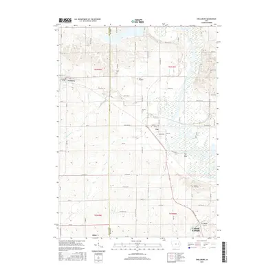
2015 Map of Shellsburg
USGS Topo · Published 2015About this map
Cedar River dominates the eastern corridor of this landscape, meandering through a wide floodplain dotted with wetlands like Mud Lake. The river's influence on local infrastructure is evident at the Chain Lakes Bridge and the Shellsburg Bridge, which connect the agrarian uplands to the riverside communities. This mid-2010s survey captures the spatial relationship between established settlements such as Shellsburg, Palo, and Atkins, showing how the road network, including Shellsburg Rd and Co Hwy E36, serves the surrounding farmsteads. Genealogical interest is anchored by several rural burial grounds, including Old Palo Cem, Strawn Cem, and Spring Grove Cem. The map also reveals subtle landforms such as The Hogback, a distinctive ridge rising above the surrounding fields. The transition from the rural village of Covington toward the northern outskirts of Cedar Rapids illustrates the persistent balance between Iowa's agricultural roots and its expanding urban edges.
Find a feature on this map
86 named features on this map. Tap any name to fly to it.
Don’t see what you’re looking for? This feature index may not catch every label — zoom into the map to look around manually.
Map Details
Editions of this 2015 Shellsburg Map
This is the sole edition of this map. No revisions or reprints were ever made.
Other maps of this area

1887 · Cedar Rapids
USGS Topo · 1:62,500

1888 · Shellsburg
USGS Topo · 1:62,500

1888 · Marion
USGS Topo · 1:62,500

1888 · Amana
USGS Topo · 1:62,500

1889 · Marion
USGS Topo · 1:62,500

1889 · Amana
USGS Topo · 1:62,500

1889 · Shellsburg
USGS Topo · 1:62,500

1891 · Cedar Rapids
USGS Topo · 1:62,500

1899 · Amana
USGS Topo · 1:62,500

1899 · Shellsburg
USGS Topo · 1:62,500