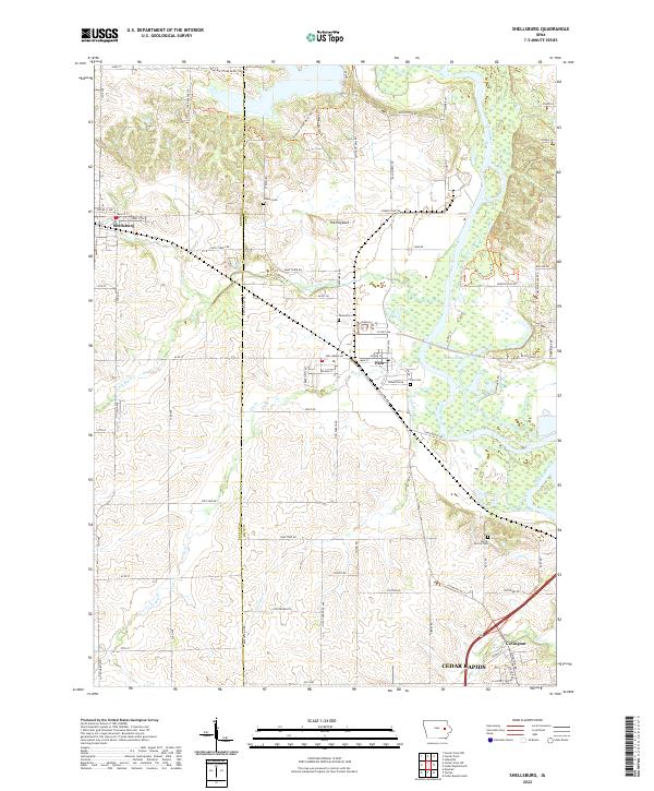
2022 Map of Shellsburg
USGS Topo · Published 2022About this map
Shellsburg and Palo anchor this portion of the Cedar River valley, where the boundary between Benton and Linn counties bisects a landscape defined by meandering waterways and agricultural tracts. The Cedar River dominates the eastern half of the map, flanked by wetland features such as Mud Lake and the recreational paths of the Wickiup Hill Park Trl. Further north, Pleasant Creek feeds into a larger multi-use area, while The Hogback stands out as a distinct topographical landmark above the surrounding creek beds.
Find a feature on this map
87 named features on this map. Tap any name to fly to it.
Don’t see what you’re looking for? This feature index may not catch every label — zoom into the map to look around manually.
Map Details
Editions of this 2022 Shellsburg Map
This is the sole edition of this map. No revisions or reprints were ever made.
Other maps of this area

1887 · Cedar Rapids
USGS Topo · 1:62,500

1888 · Shellsburg
USGS Topo · 1:62,500

1888 · Marion
USGS Topo · 1:62,500

1888 · Amana
USGS Topo · 1:62,500

1889 · Marion
USGS Topo · 1:62,500

1889 · Amana
USGS Topo · 1:62,500

1889 · Shellsburg
USGS Topo · 1:62,500

1891 · Cedar Rapids
USGS Topo · 1:62,500

1899 · Amana
USGS Topo · 1:62,500

1899 · Shellsburg
USGS Topo · 1:62,500