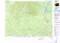
1988 Map of Shelton
USGS Topo · Published 1988About this map
The Olympic Mountains and their river-fed lowlands define this 1980s landscape, where the timber economy and tribal lands meet the inlets of the Puget Sound. This topographic study captures the region's complex geography, from the Quinault Indian Reservation in the northwest to the Skokomish Indian Reservation near Potlatch. The presence of a Logging Railroad winding through the foothills of the Olympic National Forest underscores the industrial heritage of Mason and Grays Harbor counties.
Find a feature on this map
92 named features on this map. Tap any name to fly to it.
Don’t see what you’re looking for? This feature index may not catch every label — zoom into the map to look around manually.
Map Details
Editions of this 1988 Shelton Map
This is the sole edition of this map. No revisions or reprints were ever made.
Other maps of this area

1916 · Chehalis
USGS Topo · 1:125,000

1921 · Quinault Lake
USGS Topo · 1:62,500

1921 · Satsop
USGS Topo · 1:62,500

1936 · Point Misery
USGS Topo · 1:62,500

1937 · Olympia
USGS Topo · 1:62,500

1938 · Mt Constance
USGS Topo · 1:125,000

1938 · Moclips
USGS Topo · 1:62,500

1938 · Allyn
USGS Topo · 1:62,500

1939 · Shelton
USGS Topo · 1:62,500

1940 · Tenino
USGS Topo · 1:62,500