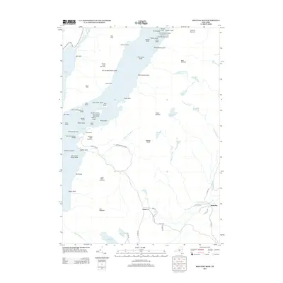
2013 Map of Shelving Rock
USGS Topo · Published 2013About this map
The eastern shore of Lake George is dominated by the protected terrain of the Adirondack Park Preserve, where the landscape rises sharply from the water toward Black Mountain and Elephant Mountain. This 2013 survey details the complex archipelago of the lake, including the Mother Bunch Islands, Sagamore Island, and the storied Floating Battery Island. While the rugged western half of the map is defined by peaks like Shelving Rock Mountain and First Peak, the southeastern corner shows the small settlement of Hogtown and the waters of South Bay. This area maintains a character of limited development, with access primarily provided by routes like Shelving Rock Rd and Hogtown Rd, which connect the scattered high-country ponds like Bumps Pond and Fishbrook Pond to the lower valley brooks.
Find a feature on this map
81 named features on this map. Tap any name to fly to it.
Don’t see what you’re looking for? This feature index may not catch every label — zoom into the map to look around manually.
Map Details
Editions of this 2013 Shelving Rock Map
This is the sole edition of this map. No revisions or reprints were ever made.
Other maps of this area

1893 · Fort Ann
USGS Topo · 1:62,500

1893 · Whitehall
USGS Topo · 1:62,500

1895 · Whitehall
USGS Topo · 1:62,500

1895 · Fort Ann
USGS Topo · 1:62,500

1895 · Glens Falls
USGS Topo · 1:62,500

1897 · Bolton
USGS Topo · 1:62,500

1897 · Glens Falls
USGS Topo · 1:62,500

1898 · Whitehall
USGS Topo · 1:62,500

1898 · Fort Ann
USGS Topo · 1:62,500

1900 · Bolton
USGS Topo · 1:62,500