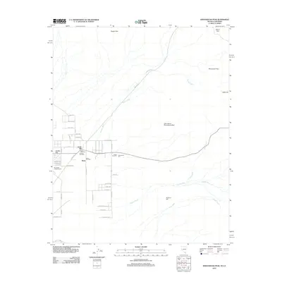
2012 Map of Shenandoah Peak
USGS Topo · Published 2012About this map
Sandy Mill and Shenandoah Mill anchor this desert landscape, revealing the industrial legacy of the Nevada-California borderlands. The transition from mining operations to residential development is evident in the grid of streets like Obsidian Ave and Nickel Ave near Lincoln City. The presence of multiple mail facilities, including the Sandy Post Office, Keystone Post Office, and Ripley Post Office, suggests a decentralized community of workers and settlers. Topographical highlights such as Shenandoah Peak and Bonanza Hill rise above a network of drainage channels like Keystone Wash and Bonanza Wash. Local aviation is represented by Sky Ranch Estates Airport, while a Cairn East of Shenandoah Mine provides a specific physical landmark for those tracing old claims and mining boundaries.
Find a feature on this map
53 named features on this map. Tap any name to fly to it.
Don’t see what you’re looking for? This feature index may not catch every label — zoom into the map to look around manually.
Map Details
Editions of this 2012 Shenandoah Peak Map
This is the sole edition of this map. No revisions or reprints were ever made.
Other maps of this area

1910 · Ivanpah
USGS Topo · 1:250,000

1912 · Ivanpah
USGS Topo · 1:250,000

1942 · Ivanpah
USGS Topo · 1:250,000

1947 · Kingman
USGS Topo · 1:250,000

1948 · Kingman
USGS Topo · 1:250,000

1954 · Kingman
USGS Topo · 1:250,000

1955 · Kingman
USGS Topo · 1:250,000

1955 · Roach Lake
USGS Topo · 1:62,500

1956 · Clark Mountain
USGS Topo · 1:62,500

1956 · Shenandoah Peak
USGS Topo · 1:62,500