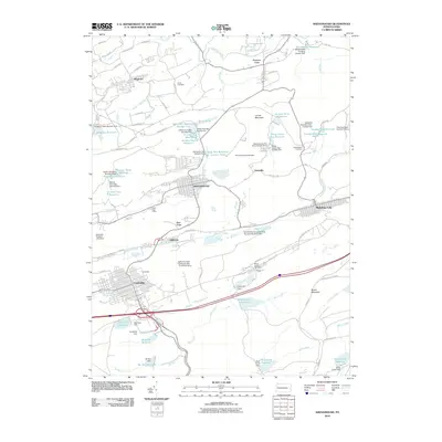
2010 Map of Shenandoah
USGS Topo · Published 2010About this map
Locust Mountain and Bear Ridge define the industrial and residential geography of the Anthracite Coal Region in this 2010 survey. The map details the dense urban grids of Shenandoah and Mahanoy City, separated by the high ridges that necessitated the region's complex water management systems. A remarkable number of reservoirs, including the Kehly Run Reservoir Number Five and Raven Run Reservoir, are nestled into the slopes to support these hilltop and valley settlements.
Find a feature on this map
94 named features on this map. Tap any name to fly to it.
Don’t see what you’re looking for? This feature index may not catch every label — zoom into the map to look around manually.
Map Details
Editions of this 2010 Shenandoah Map
This is the sole edition of this map. No revisions or reprints were ever made.
Other maps of this area

1889 · Catawissa
USGS Topo · 1:62,500

1889 · Pottsville
USGS Topo · 1:62,500

1891 · Pottsville
USGS Topo · 1:62,500

1892 · Catawissa
USGS Topo · 1:62,500

1892 · Mahanoy
USGS Topo · 1:62,500

1892 · Pine Grove
USGS Topo · 1:62,500

1893 · Mahanoy
USGS Topo · 1:62,500

1894 · Catawissa
USGS Topo · 1:62,500

1944 · Pottsville
USGS Topo · 1:24,000

1944 · Orwigsburg
USGS Topo · 1:24,000