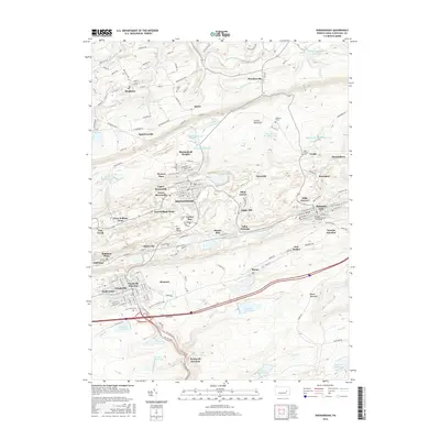
2016 Map of Shenandoah
USGS Topo · Published 2016About this map
Shenandoah and Mahanoy City anchor this portrait of Pennsylvania's coal country, where the landscape is defined by its deep industrial roots. The map shows the dense grid of the valley floor contrasting with the high ridges of Locust Mountain and Broad Mountain. This era illustrates a region shaped by extractive industry, now managed through an extensive network of water resources such as the Mahanoy Township Reservoirs, Raven Run Reservoirs, and Kehley Run Reservoirs. The presence of several distinct residential pockets, including Turkey Run, Maple Hill, and Shenandoah Heights, suggests the historical development of company towns and ethnic enclaves.
Find a feature on this map
146 named features on this map. Tap any name to fly to it.
Don’t see what you’re looking for? This feature index may not catch every label — zoom into the map to look around manually.
Map Details
Editions of this 2016 Shenandoah Map
This is the sole edition of this map. No revisions or reprints were ever made.
Other maps of this area

1889 · Catawissa
USGS Topo · 1:62,500

1889 · Pottsville
USGS Topo · 1:62,500

1891 · Pottsville
USGS Topo · 1:62,500

1892 · Catawissa
USGS Topo · 1:62,500

1892 · Mahanoy
USGS Topo · 1:62,500

1892 · Pine Grove
USGS Topo · 1:62,500

1893 · Mahanoy
USGS Topo · 1:62,500

1894 · Catawissa
USGS Topo · 1:62,500

1944 · Pottsville
USGS Topo · 1:24,000

1944 · Orwigsburg
USGS Topo · 1:24,000