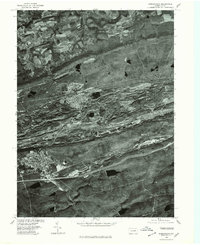
1976 Map of Shenandoah
USGS Topo · Published 1979About this map
Shenandoah and its surrounding coal-patch towns are captured in high-detail 1976 aerial photography, revealing a landscape deeply marked by decades of anthracite extraction. The view stretches across the parallel ridges and valleys of Schuylkill County, where the dense urban grids of Mahanoy City and Gilberton contrast sharply with the industrial scars on the floor of the valley. To the north, the terrain transitions into the more open, agricultural fields around Ringtown and Brandonville. This orthophotoquad provides a clear perspective on the spatial relationship between the borough centers and the massive topographical shifts caused by surface mining along Locust Mountain. In the south, the expansion of Frackville is visible near the steep slopes of Broad Mountain, documenting the area's development during the late twentieth century.
Find a feature on this map
9 named features on this map. Tap any name to fly to it.
Don’t see what you’re looking for? This feature index may not catch every label — zoom into the map to look around manually.
Map Details
Editions of this 1976 Shenandoah Map
This is the sole edition of this map. No revisions or reprints were ever made.
Other maps of this area

1889 · Catawissa
USGS Topo · 1:62,500

1889 · Pottsville
USGS Topo · 1:62,500

1891 · Pottsville
USGS Topo · 1:62,500

1892 · Catawissa
USGS Topo · 1:62,500

1892 · Mahanoy
USGS Topo · 1:62,500

1892 · Pine Grove
USGS Topo · 1:62,500

1893 · Mahanoy
USGS Topo · 1:62,500

1894 · Catawissa
USGS Topo · 1:62,500

1944 · Pottsville
USGS Topo · 1:24,000

1944 · Orwigsburg
USGS Topo · 1:24,000