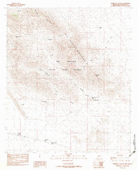
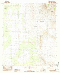
1982 Map of Sheridan Canyon
USGS Topo · Published 1982About this map
Big Hatchet State Game Refuge dominates this section of the Big Hatchet Mountains in Hidalgo County, New Mexico. The high-altitude landscape is defined by its series of deep drainages and ridges, including Sheridan Canyon and Bugle Ridge. This 1982 map highlights a complex network of water infrastructure vital to the arid environment, such as the colorfully named Hell To Get To Tank and Hell To Finish Tank.
Find a feature on this map
24 named features on this map. Tap any name to fly to it.
Don’t see what you’re looking for? This feature index may not catch every label — zoom into the map to look around manually.
Map Details
Editions of this 1982 Sheridan Canyon Map
This is the sole edition of this map. No revisions or reprints were ever made.
Other maps of this area

1918 · Big Hatchet Peak
USGS Topo · 1:62,500

1918 · Dog Mountains
USGS Topo · 1:62,500

1955 · Douglas
USGS Topo · 1:250,000

1959 · Douglas
USGS Topo · 1:250,000

1961 · Douglas
USGS Topo · 1:250,000

1964 · Douglas
USGS Topo · 1:250,000
1982 · Big Hatchet Peak
USGS Topo · 1:24,000
1982 · Pierce Peak
USGS Topo · 1:24,000
1982 · Hatchet Ranch
USGS Topo · 1:24,000
1982 · U Bar Ridge
USGS Topo · 1:24,000