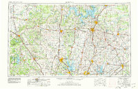
1954 Map of Sherman
USGS Topo · Published 1978About this map
The Red River forms the winding border between Texas and Oklahoma, anchoring a North Texas landscape defined by mid-century water management and infrastructure. In this 1950s survey, updated in the late 1970s, the emergence of major reservoirs like Lake Texoma, Lewisville Lake, and Lake Ray Roberts dominates the terrain, fundamentally altering the drainage of the Elm Fork Trinity River and Denton Creek. The map documents a critical period of urban expansion for Sherman, Denton, and McKinney, before the full onset of modern suburban sprawl.
Find a feature on this map
145 named features on this map. Tap any name to fly to it.
Don’t see what you’re looking for? This feature index may not catch every label — zoom into the map to look around manually.
Map Details
Editions of this 1954 Sherman Map
2 editions found

Other maps of this area

1891 · Weatherford
USGS Topo · 1:125,000

1891 · Dallas
USGS Topo · 1:125,000

1891 · Palo Pinto
USGS Topo · 1:125,000

1893 · Dallas
USGS Topo · 1:125,000

1893 · Weatherford
USGS Topo · 1:125,000

1894 · Fort Worth
USGS Topo · 1:125,000

1899 · Atoka
USGS Topo · 1:125,000

1900 · Atoka
USGS Topo · 1:125,000

1901 · Addington
USGS Topo · 1:125,000

1901 · Tishomingo
USGS Topo · 1:125,000