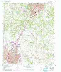
1958 Map of Sherman
USGS Topo · Published 1991About this map
Sherman and southern Denison appear here as thriving North Texas hubs during a period of significant post-war expansion. The landscape is defined by a dense network of major rail lines, including the Missouri-Kansas-Texas Railroad and the St Louis Southwestern Railroad, which converge at industrial junctions like North Sherman Junction. In the heart of Sherman, the campus of Austin College stands near numerous local landmarks like St Josephs Academy and Douglass High Sch.
Find a feature on this map
67 named features on this map. Tap any name to fly to it.
Don’t see what you’re looking for? This feature index may not catch every label — zoom into the map to look around manually.
Map Details
Editions of this 1958 Sherman Map
3 editions found

Other maps of this area

1901 · Denison
USGS Topo · 1:125,000

1954 · Sherman
USGS Topo · 1:250,000

1957 · Denison Dam
USGS Topo · 1:24,000

1958 · Durant
USGS Topo · 1:62,500

1958 · Dorchester
USGS Topo · 1:24,000

1958 · Whitesright
USGS Topo · 1:62,500

1958 · Denison Dam
USGS Topo · 1:62,500

1958 · Sherman NW
USGS Topo · 1:24,000

1958 · Sherman
USGS Topo · 1:250,000

1958 · Sherman
USGS Topo · 1:62,500