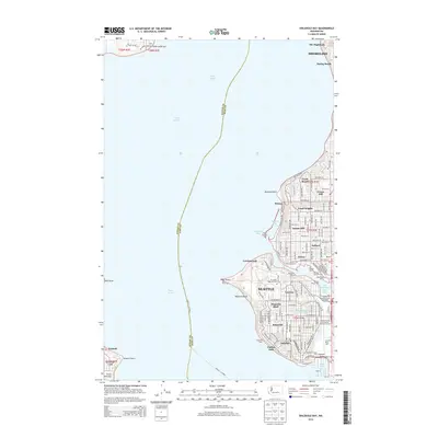
2014 Map of Shilshole Bay
USGS Topo · Published 2014About this map
Puget Sound and the intricate maritime infrastructure of northwest Seattle dominate this 2014 topographic study. The map documents the vital transition between the saltwater sound and inland waters through the Lake Washington Ship Canal, anchored by the Canal Entrance Light and the sprawling Shilshole Bay Marina. Residential neighborhoods such as Ballard, Magnolia Bluff, and Loyal Heights are shown in detail, illustrating the dense urban grid that climbs away from the shoreline.
Find a feature on this map
75 named features on this map. Tap any name to fly to it.
Don’t see what you’re looking for? This feature index may not catch every label — zoom into the map to look around manually.
Map Details
Editions of this 2014 Shilshole Bay Map
This is the sole edition of this map. No revisions or reprints were ever made.
Other maps of this area

1894 · Seattle
USGS Topo · 1:62,500

1895 · Snohomish
USGS Topo · 1:125,000

1897 · Seattle
USGS Topo · 1:125,000

1908 · Seattle
USGS Topo · 1:62,500

1909 · Seattle Special
USGS Topo · 1:62,500

1937 · Port Orchard
USGS Topo · 1:62,500

1937 · Port Gamble
USGS Topo · 1:62,500

1940 · Port Gamble
USGS Topo · 1:62,500

1942 · Edmonds
USGS Topo · 1:62,500

1949 · Shilshole Bay
USGS Topo · 1:24,000