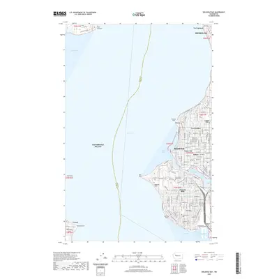
2020 Map of Shilshole Bay
USGS Topo · Published 2020About this map
Ballard and the northern neighborhoods of Seattle define the eastern shoreline of this coastal survey, where the Lake Washington Ship Canal connects Salmon Bay to the deep waters of the Puget Sound. The landscape is a dense grid of residential development across Sunset Hill, Loyal Heights, and Crown Hill. To the south, the prominent rise of Magnolia Bluff overlooks the sound, housing the Fort Lawton Military Cem and the Magnolia Manor Reservoir.
Find a feature on this map
82 named features on this map. Tap any name to fly to it.
Don’t see what you’re looking for? This feature index may not catch every label — zoom into the map to look around manually.
Map Details
Editions of this 2020 Shilshole Bay Map
This is the sole edition of this map. No revisions or reprints were ever made.
Other maps of this area

1894 · Seattle
USGS Topo · 1:62,500

1895 · Snohomish
USGS Topo · 1:125,000

1897 · Seattle
USGS Topo · 1:125,000

1908 · Seattle
USGS Topo · 1:62,500

1909 · Seattle Special
USGS Topo · 1:62,500

1937 · Port Orchard
USGS Topo · 1:62,500

1937 · Port Gamble
USGS Topo · 1:62,500

1940 · Port Gamble
USGS Topo · 1:62,500

1942 · Edmonds
USGS Topo · 1:62,500

1949 · Shilshole Bay
USGS Topo · 1:24,000