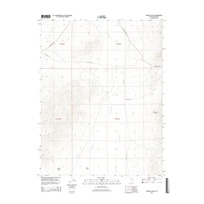
2015 Map of Shingle Pass SE
USGS Topo · Published 2015About this map
Cave Valley sits at the center of this high-desert landscape in Lincoln County, defined by the drainage networks of Big Spring Wash and Cave Valley Wash. The terrain is bounded to the east by the rising elevations of the Schell Creek Range, where Quartzite Spring provides a critical water source in an otherwise arid environment. To the southwest, the topography descends into Sawmill Canyon, a name that suggests historical timber activity in this Great Basin region.
Find a feature on this map
15 named features on this map. Tap any name to fly to it.
Don’t see what you’re looking for? This feature index may not catch every label — zoom into the map to look around manually.
Map Details
Editions of this 2015 Shingle Pass SE Map
This is the sole edition of this map. No revisions or reprints were ever made.
Other maps of this area

1956 · Lund
USGS Topo · 1:250,000

1960 · Lund
USGS Topo · 1:250,000

1969 · Shingle Pass
USGS Topo · 1:24,000

1969 · Parker Station
USGS Topo · 1:24,000

1969 · Shingle Pass SE
USGS Topo · 1:24,000

1969 · Haggerty Spring
USGS Topo · 1:24,000

1971 · Sidehill Spring
USGS Topo · 1:24,000

1971 · Cave Valley Well
USGS Topo · 1:24,000
1973 · Dutch John Mtn
USGS Topo · 1:24,000
1978 · Mt. Grafton
USGS Topo · 1:24,000