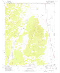
1973 Map of Dutch John Mtn
USGS Topo · Published 1977About this map
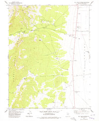
The high-altitude basins and ranges of eastern Nevada define this 1970s landscape, centered on the prominent ridge of Dutch John Mountain. To the west, the Schell Creek Range overlooks the Muleshoe Valley, a region where survival is tied to scattered water sources like Chris Spring and the South Milk Ranch Well. The topography reveals a network of primitive access routes, including various unnamed Jeep Trails that navigate through Grassy Pass and reach toward Muleshoe Summit. To the east, the terrain drops into the stark expanse of the Lake Valley (Depression). The map records several vital water points for cattle ranching or mineral exploration, such as the North Dutch John Well and Shaffer Well, providing a detailed look at how this arid territory was managed and traversed in the early 1970s.
Find a feature on this map
20 named features on this map. Tap any name to fly to it.
Don’t see what you’re looking for? This feature index may not catch every label — zoom into the map to look around manually.
Map Details
Editions of this 1973 Dutch John Mtn Map
This is the sole edition of this map. No revisions or reprints were ever made.
Other maps of this area

1956 · Lund
USGS Topo · 1:250,000

1960 · Lund
USGS Topo · 1:250,000

1969 · Shingle Pass SE
USGS Topo · 1:24,000

1971 · Sidehill Spring
USGS Topo · 1:24,000

1971 · Sidehill Pass
USGS Topo · 1:24,000

1973 · Gouge Eye Well
USGS Topo · 1:24,000
1973 · Grassy Mtn
USGS Topo · 1:24,000
1973 · Mustang Well
USGS Topo · 1:24,000
1973 · Pony Springs
USGS Topo · 1:24,000
1978 · Milk Ranch Spring
USGS Topo · 1:24,000