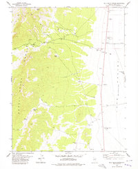
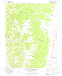
1978 Map of Milk Ranch Spring
USGS Topo · Published 1979About this map
The Schell Creek Range dominates this landscape, rising steeply above the Lake Valley (Depression) in eastern Lincoln County. In the late 1970s, the area reflects a remote ranching and exploratory character, where water access defines survival and land use. Natural water sources like Milk Ranch Spring, Schwartz Spring, and Rosebud Spring dot the mountain slopes, while man-made infrastructure like the Milk Ranch Well and South Lake Valley Well No 1 support activity in the valley floor. The geography here is marked by human persistence in an arid environment, seen in the numerous Gravel Pits and several Drill Holes that suggest mineral prospecting near Patterson Pass. Connectivity is maintained through a network of Trails and Jeep Trails, providing access to isolated landmarks such as a lone Corral and the Roadside Spring.
Find a feature on this map
21 named features on this map. Tap any name to fly to it.
Don’t see what you’re looking for? This feature index may not catch every label — zoom into the map to look around manually.
Map Details
Editions of this 1978 Milk Ranch Spring Map
This is the sole edition of this map. No revisions or reprints were ever made.
Other maps of this area

1956 · Lund
USGS Topo · 1:250,000

1960 · Lund
USGS Topo · 1:250,000

1969 · Parker Station
USGS Topo · 1:24,000

1969 · Shingle Pass SE
USGS Topo · 1:24,000

1971 · Sidehill Spring
USGS Topo · 1:24,000

1973 · Gouge Eye Well
USGS Topo · 1:24,000
1973 · Dutch John Mtn
USGS Topo · 1:24,000
1973 · Mustang Well
USGS Topo · 1:24,000
1973 · Mount Grafton NE
USGS Topo · 1:24,000
1978 · Mt. Grafton
USGS Topo · 1:24,000