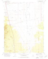
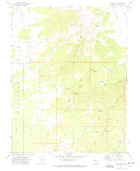
1973 Map of Pony Springs
USGS Topo · Published 1977About this map
Pony Springs serves as a small waypoint along the western edge of the expansive Lake Valley Depression, where water management was critical for ranching and travel in the early 1970s. The landscape is defined by a sophisticated network of water sources, ranging from the Mendenhall Well and Pony Spring Well in the north to the Spotlight Well and Divide Reservoir further south. This reliance on groundwater is evident in the numerous wells and springs scattered across the basin floor. To the west, the Fairview Range and The Cedars provide a dramatic elevation change, where a rugged Jeep Trail climbs past Mark Spring. The map reveals the infrastructure of a working Great Basin landscape, documented through its borrow pits, fences, and a roadside Rest Area near the main thoroughfare.
Find a feature on this map
24 named features on this map. Tap any name to fly to it.
Don’t see what you’re looking for? This feature index may not catch every label — zoom into the map to look around manually.
Map Details
Editions of this 1973 Pony Springs Map
This is the sole edition of this map. No revisions or reprints were ever made.
Other maps of this area

1915 · Bristol Range
USGS Topo · 1:62,500

1917 · Bristol Range
USGS Topo · 1:62,500

1956 · Lund
USGS Topo · 1:250,000

1960 · Lund
USGS Topo · 1:250,000
1970 · Mt. Wilson
USGS Topo · 1:24,000
1971 · Bristol Range NE
USGS Topo · 1:24,000
1971 · Fairview Peak
USGS Topo · 1:24,000

1973 · Schoolmarm Basin
USGS Topo · 1:24,000

1973 · Horse Corral Pass
USGS Topo · 1:24,000
1973 · Grassy Mtn
USGS Topo · 1:24,000