
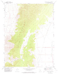
1971 Map of Cave Valley Well
USGS Topo · Published 1973About this map
Egan Range peaks dominate this high-altitude landscape along the border of Nye and Lincoln Counties in the early 1970s. The map captures a stark divide between two arid basins, with the mountain spine separating the White River Valley to the west from the Cave Valley to the east. Water sources are scarce in this environment, represented here by the namesake Cave Valley Well and the drainage of Trough Spring Canyon. A network of a Jeep Trail provides the primary means of navigation through the steep terrain, illustrating the remote and undeveloped nature of the Great Basin at the time of the survey. The absence of settlements or paved roads highlights the area's isolation and its primary use for grazing or transition between the valley floors.
Find a feature on this map
7 named features on this map. Tap any name to fly to it.
Don’t see what you’re looking for? This feature index may not catch every label — zoom into the map to look around manually.
Map Details
Editions of this 1971 Cave Valley Well Map
2 editions found
Other maps of this area

1956 · Lund
USGS Topo · 1:250,000

1960 · Lund
USGS Topo · 1:250,000

1969 · Gap Mountain
USGS Topo · 1:24,000

1969 · Shingle Pass
USGS Topo · 1:24,000

1969 · Sunnyside
USGS Topo · 1:24,000

1969 · Moorman Spring SE
USGS Topo · 1:24,000

1969 · Shingle Pass SE
USGS Topo · 1:24,000

1971 · Sidehill Spring
USGS Topo · 1:24,000

1971 · Sidehill Pass
USGS Topo · 1:24,000
1971 · Silver King Well
USGS Topo · 1:24,000