
1969 Map of Gap Mountain
USGS Topo · Published 1971About this map
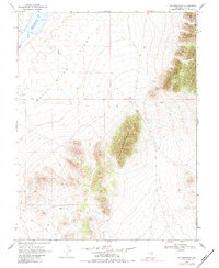
White River Valley dominates the western half of this 1969 field-checked landscape, where the White River and Hot Creek meet before flowing into the Adams-Mcgill Res. The eastern terrain rises sharply toward the prominence of Gap Mountain, a significant high point along the boundary of Nye and Lincoln counties. This era of land use is marked by a network of Jeep Trails and scattered evidence of resource exploration, including a Drill Hole and several named Prospects. The map provides a clear look at the arid topography and hydraulic features of this part of Nevada before late-twentieth-century developments, preserving the exact locations of mountain saddles and ephemeral water courses that define the Great Basin character.
Find a feature on this map
10 named features on this map. Tap any name to fly to it.
Don’t see what you’re looking for? This feature index may not catch every label — zoom into the map to look around manually.
Map Details
Editions of this 1969 Gap Mountain Map
2 editions found
Other maps of this area

1956 · Lund
USGS Topo · 1:250,000

1960 · Lund
USGS Topo · 1:250,000

1969 · Sunnyside
USGS Topo · 1:24,000

1969 · Hot Creek Butte
USGS Topo · 1:24,000

1969 · Sunnyside NW
USGS Topo · 1:24,000
1971 · Timber Mtn Pass NW
USGS Topo · 1:24,000
1971 · Timber Mtn Pass NE
USGS Topo · 1:24,000

1971 · Cave Valley Well
USGS Topo · 1:24,000

1971 · Silver King Mtn
USGS Topo · 1:24,000
1971 · Silver King Well
USGS Topo · 1:24,000