
1969 Map of Hot Creek Butte
USGS Topo · Published 1971About this map
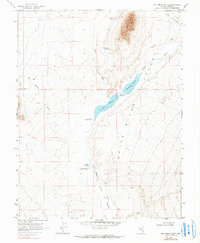
White River Valley defines the landscape of this region, where water management is critical to the local economy. At the time of this late-1960s survey, a series of water control structures including Tule Field Reservoir, Hay Meadow Reservoir, and Whipple Reservoir were established along the White River. These reservoirs, marked with specific spillway elevations, suggest a carefully regulated irrigation or livestock system within the arid basin. Near the northeastern corner, Hot Creek Butte rises as a prominent landmark overlooking the Forest Moon Ranch and its adjacent Landing Strip. The map also traces a network of perennial and intermittent water sources, such as Moon River Spring, Camp Spring, and the Murphy Meadows River, which provided essential resources for the ranching operations that historically anchored this part of Nye County.
Find a feature on this map
18 named features on this map. Tap any name to fly to it.
Don’t see what you’re looking for? This feature index may not catch every label — zoom into the map to look around manually.
Map Details
Editions of this 1969 Hot Creek Butte Map
2 editions found
Other maps of this area

1956 · Lund
USGS Topo · 1:250,000

1960 · Lund
USGS Topo · 1:250,000

1964 · Forest Home
USGS Topo · 1:62,500

1969 · Gap Mountain
USGS Topo · 1:24,000

1969 · Sunnyside
USGS Topo · 1:24,000

1969 · Sunnyside NW
USGS Topo · 1:24,000
1971 · Timber Mtn Pass NW
USGS Topo · 1:24,000
1971 · Timber Mtn Pass NE
USGS Topo · 1:24,000
1985 · Water Gap NE
USGS Topo · 1:24,000

1988 · Quinn Canyon Range
USGS Topo · 1:100,000