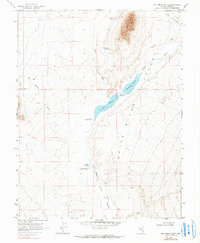
1969 Map of Hot Creek Butte
USGS Topo · Published 1990About this map
The White River Valley defines this high-desert landscape in eastern Nevada, where water management is central to the remote settlement pattern. Collected within the broad flats of the valley, the Hay Meadow Reservoir, Tule Field Reservoir, and Whipple Reservoir trace a line of vital irrigation and livestock infrastructure along the White River. This 1960s survey captures the region just as it appeared before minor modern changes, focusing on the isolated ranching outposts that relied on these waters.
Find a feature on this map
14 named features on this map. Tap any name to fly to it.
Don’t see what you’re looking for? This feature index may not catch every label — zoom into the map to look around manually.
Map Details
Editions of this 1969 Hot Creek Butte Map
2 editions found
Other maps of this area

1956 · Lund
USGS Topo · 1:250,000

1960 · Lund
USGS Topo · 1:250,000

1964 · Forest Home
USGS Topo · 1:62,500

1969 · Gap Mountain
USGS Topo · 1:24,000

1969 · Sunnyside
USGS Topo · 1:24,000

1969 · Hot Creek Butte
USGS Topo · 1:24,000

1969 · Sunnyside NW
USGS Topo · 1:24,000
1971 · Timber Mtn Pass NW
USGS Topo · 1:24,000
1971 · Timber Mtn Pass NE
USGS Topo · 1:24,000
1985 · Water Gap NE
USGS Topo · 1:24,000