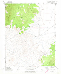
1971 Map of Silver King Well
USGS Topo · Published 1973About this map
The Silver King Mine stands as a central industrial point in this high-desert landscape of eastern Nevada, situated between the Egan Range and the Schell Creek Range. Surveyed in the early 1970s, the terrain is defined by the arid Cave Valley, where water access was critical for mining operations and ranching. This is evidenced by a network of scattered water sources including Silver King Well, Lewis Well, and Griswold Well.
Find a feature on this map
17 named features on this map. Tap any name to fly to it.
Don’t see what you’re looking for? This feature index may not catch every label — zoom into the map to look around manually.
Map Details
Editions of this 1971 Silver King Well Map
3 editions found
Other maps of this area

1956 · Lund
USGS Topo · 1:250,000

1960 · Lund
USGS Topo · 1:250,000

1969 · Gap Mountain
USGS Topo · 1:24,000

1969 · Sunnyside
USGS Topo · 1:24,000

1971 · Sidehill Spring
USGS Topo · 1:24,000

1971 · Bailey Wash
USGS Topo · 1:24,000
1971 · Timber Mtn Pass NE
USGS Topo · 1:24,000

1971 · Cave Valley Well
USGS Topo · 1:24,000

1971 · Silver King Mtn
USGS Topo · 1:24,000

1971 · Sidehill Pass
USGS Topo · 1:24,000