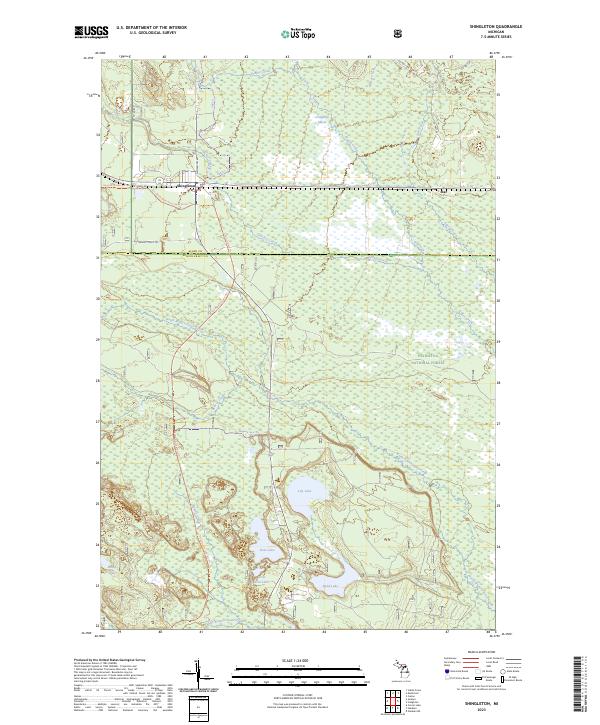
2023 Map of Shingleton
USGS Topo · Published 2023About this map
Hiawatha National Forest dominates this section of the Upper Peninsula, where the landscape is defined by extensive wetlands and interconnected water systems. The small community of Shingleton serves as a local hub near the intersection of major forest routes, including the Haywire State Trl and the Marquette-Manistique Route Trl. These trails follow the corridors of former industrial transport lines, reflecting the region's logging and rail history. To the east, the settlement of Star sits along the northern edge of a vast marshy plain drained by Hickey Creek and Prairie Creek. To the south, the terrain transitions into a cluster of glacial lakes, including Lily Lake, Boot Lake, and Sand Lake, surrounded by dense forest. The map detail provides a clear view of the complex drainage patterns of the North Branch Stutts Creek and Beaver Creek as they meander through the Creighton Marsh.
Find a feature on this map
33 named features on this map. Tap any name to fly to it.
Don’t see what you’re looking for? This feature index may not catch every label — zoom into the map to look around manually.
Map Details
Editions of this 2023 Shingleton Map
This is the sole edition of this map. No revisions or reprints were ever made.
Other maps of this area

1931 · Steuben NE
USGS Topo · 1:31,680

1931 · Shingleton SW
USGS Topo · 1:31,680

1931 · Steuben NW
USGS Topo · 1:31,680

1931 · Shingleton NE
USGS Topo · 1:31,680

1931 · Skeels Lake NE
USGS Topo · 1:31,680

1931 · Shingleton SE
USGS Topo · 1:31,680

1931 · Munising SE
USGS Topo · 1:31,680

1958 · Corner Lake
USGS Topo · 1:62,500

1958 · Munising
USGS Topo · 1:62,500

1958 · Shingleton
USGS Topo · 1:62,500