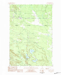
1983 Map of Shingleton
USGS Topo · Published 1984About this map
Shingleton sits at the northern edge of this Upper Peninsula landscape, where the Soo Line railroad bisects a region defined by managed timberlands and wildlife conservation. The northern reaches are occupied by the Cusino State Wildlife Research Area and Munising State Forest, featuring the notable Camp Cusino State Prison. To the south, the terrain transitions into the Hiawatha National Forest, a territory mapped through its network of resource-management paths like the Hanley Truck Trail and the Haywire Grade.
Find a feature on this map
31 named features on this map. Tap any name to fly to it.
Don’t see what you’re looking for? This feature index may not catch every label — zoom into the map to look around manually.
Map Details
Editions of this 1983 Shingleton Map
This is the sole edition of this map. No revisions or reprints were ever made.
Other maps of this area

1931 · Steuben NE
USGS Topo · 1:31,680

1931 · Shingleton SW
USGS Topo · 1:31,680

1931 · Steuben NW
USGS Topo · 1:31,680

1931 · Shingleton NE
USGS Topo · 1:31,680

1931 · Skeels Lake NE
USGS Topo · 1:31,680

1931 · Shingleton SE
USGS Topo · 1:31,680

1931 · Munising SE
USGS Topo · 1:31,680

1958 · Corner Lake
USGS Topo · 1:62,500

1958 · Munising
USGS Topo · 1:62,500

1958 · Shingleton
USGS Topo · 1:62,500