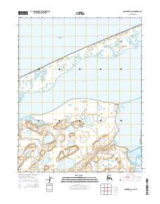
2014 Map of Shishmaref B-1 NE
USGS Topo · Published 2014About this map
The Bering Land Bridge National Preserve dominates this coastal landscape, where the waters of the Chukchi Sea meet the intricate shorelines of the Seward Peninsula. The mapping focuses on the transitional zone between open sea and protected inland waters, featuring the broad expanse of Shishmaref Inlet and the smaller Coupack Inlet. This environment is characterized by a complex network of lagoons and wetlands, indicative of the shifting coastal dynamics of the Arctic. Navigation through this water-rich terrain is facilitated by the Inlet Bypass, a specialized route through the marshy lowlands south of the primary inlet. The survey provides a clear view of the Public Land Survey System grid across these remote northern townships, documenting the geography of one of the most significant protected wilderness areas in Alaska.
Find a feature on this map
11 named features on this map. Tap any name to fly to it.
Don’t see what you’re looking for? This feature index may not catch every label — zoom into the map to look around manually.
Map Details
Editions of this 2014 Shishmaref B-1 NE Map
This is the sole edition of this map. No revisions or reprints were ever made.
Other maps of this area

1950 · Kotzebue C-6
USGS Topo · 1:63,360

1950 · Shishmaref
USGS Topo · 1:250,000

1950 · Shishmaref B-1
USGS Topo · 1:63,360

1950 · Kotzebue B-6
USGS Topo · 1:63,360

1951 · Shishmaref
USGS Topo · 1:250,000

1951 · Kotzebue
USGS Topo · 1:250,000

1958 · Kotzebue
USGS Topo · 1:250,000

1964 · Kotzebue
USGS Topo · 1:250,000
2014 · Shishmaref B-1 NW
USGS Topo · 1:25,000
2014 · Kotzebue B-6 SW
USGS Topo · 1:25,000