
1950 Map of Kotzebue B-6
USGS Topo · Published 1957About this map
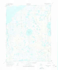
Shishmaref Inlet defines the northern coastline of this Arctic landscape, where the sea meets a complex network of freshwater lakes and tundra rivers. This 1950s study, based on aerial photography from the late 1940s, reveals a terrain dominated by water and shifting elevations. Large features like White Fish Lake and the Devil Mountain Lakes sit nestled between drainage systems like the Singraukpuk River and the Katik River. The map highlights the localized relief of the Seward Peninsula, specifically at Devil Mountain and Round Vabm 368. Farther south, the meandering Cowpack River and its tributary, Branch Cowpack River, weave through a low-lying expanse dotted with hundreds of unnamed ponds, illustrating the intricate hydrology of the region before modern development.
Find a feature on this map
10 named features on this map. Tap any name to fly to it.
Don’t see what you’re looking for? This feature index may not catch every label — zoom into the map to look around manually.
Map Details
Editions of this 1950 Kotzebue B-6 Map
2 editions found
Other maps of this area

1950 · Kotzebue C-6
USGS Topo · 1:63,360

1950 · Shishmaref
USGS Topo · 1:250,000
1950 · Kotzebue C-5
USGS Topo · 1:63,360

1950 · Shishmaref A-1
USGS Topo · 1:63,360

1950 · Kotzebue A-6
USGS Topo · 1:63,360

1950 · Shishmaref B-1
USGS Topo · 1:63,360

1950 · Kotzebue B-5
USGS Topo · 1:63,360

1950 · Kotzebue A-5
USGS Topo · 1:63,360

1951 · Shishmaref
USGS Topo · 1:250,000

1951 · Kotzebue
USGS Topo · 1:250,000