
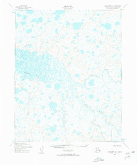
1950 Map of Shishmaref A-1
USGS Topo · Published 1957About this map
The Serpentine River meanders across this subarctic landscape, characterized by an intricate network of wetlands and tundra ponds typical of the Seward Peninsula. Mapped from aerial photographs taken in 1949 and 1950, the area is defined by its complex hydrology where the North Fork Serpentine River and the South Fork converge. To the north, the Cowpack River flows through a similarly saturated terrain, while the southern reaches are marked by several tributaries including Eldorado Creek, Grayling Creek, and Lone Butte Creek. A rare point of relief in this low-lying marshland is the Trouble VABM 206 survey marker, which stands out against the countless unnamed lakes and basins. The absence of roads or trails on this 1950s record emphasizes the isolation of the second judicial division during this period of mid-century geological survey.
Find a feature on this map
8 named features on this map. Tap any name to fly to it.
Don’t see what you’re looking for? This feature index may not catch every label — zoom into the map to look around manually.
Map Details
Editions of this 1950 Shishmaref A-1 Map
2 editions found
Other maps of this area

1950 · Bendeleben D-6
USGS Topo · 1:63,360

1950 · Teller
USGS Topo · 1:250,000

1950 · Bendeleben
USGS Topo · 1:250,000

1950 · Shishmaref
USGS Topo · 1:250,000

1950 · Kotzebue A-6
USGS Topo · 1:63,360

1950 · Teller D-2
USGS Topo · 1:63,360

1950 · Shishmaref B-1
USGS Topo · 1:63,360

1950 · Shishmaref A-2
USGS Topo · 1:63,360
1950 · Shishmaref B-2
USGS Topo · 1:63,360

1950 · Kotzebue B-6
USGS Topo · 1:63,360