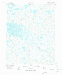
1950 Map of Shishmaref A-1
USGS Topo · Published 1957About this map
The Serpentine River dominates this mid-century survey, winding through an intricate network of wetlands and tundra on the Seward Peninsula. Compiled from aerial photography taken between 1949 and 1950, the map illustrates the complex hydrology of the region before any modern infrastructure altered the drainage patterns. Tributaries such as the North Fork Serpentine River and Eldorado Creek feed into the main channel, while the northern reaches are defined by the Cowpack River. The lack of road classifications or trails in the area highlights the remote character of this landscape during the post-war era. Topographic details are anchored by geodetic markers like Trouble VABM 206, providing a precise look at the elevation changes across this water-saturated terrain, including the courses of Grayling Creek and Lone Butte Creek.
Find a feature on this map
7 named features on this map. Tap any name to fly to it.
Don’t see what you’re looking for? This feature index may not catch every label — zoom into the map to look around manually.
Map Details
Editions of this 1950 Shishmaref A-1 Map
2 editions found
Other maps of this area

1950 · Bendeleben D-6
USGS Topo · 1:63,360

1950 · Teller
USGS Topo · 1:250,000

1950 · Bendeleben
USGS Topo · 1:250,000

1950 · Shishmaref
USGS Topo · 1:250,000

1950 · Shishmaref A-1
USGS Topo · 1:63,360

1950 · Kotzebue A-6
USGS Topo · 1:63,360

1950 · Teller D-2
USGS Topo · 1:63,360

1950 · Shishmaref B-1
USGS Topo · 1:63,360

1950 · Shishmaref A-2
USGS Topo · 1:63,360
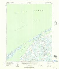
1950 · Shishmaref B-2
USGS Topo · 1:63,360