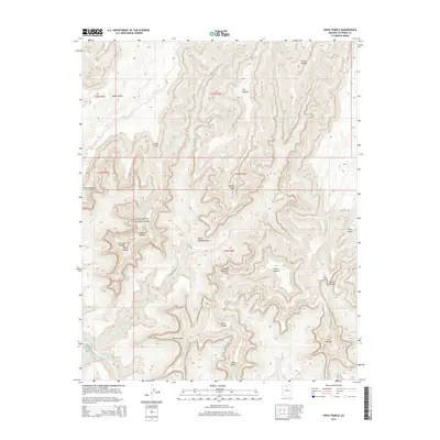
2014 Map of Shiva Temple
USGS Topo · Published 2014About this map
Grand Canyon National Park contains some of the most dramatically named geological formations in the American Southwest. The terrain within this 2014 survey is defined by massive isolated mesas and buttes, many bearing names inspired by mythology and ancient philosophy, such as the Shiva Temple, Confucius Temple, and Osiris Temple. These features are carved by a complex network of drainages including Crystal Creek and Dragon Creek, which flow toward the southern boundary marked by the Colorado River. A distinctive topographical insight is found at Hindu Amphitheater, a massive natural basin that highlights the erosion patterns characteristic of the North Rim region. Higher elevations like Point Sublime and Claude Birdseye Point provide survey benchmarks overlooking deep side canyons such as Outlet Canyon. The map reveals the intricate relationship between the high plateaus of Walla Valley and the sheer drops into the drainage systems of Ninetyone Mile Creek.
Find a feature on this map
32 named features on this map. Tap any name to fly to it.
Don’t see what you’re looking for? This feature index may not catch every label — zoom into the map to look around manually.
Map Details
Editions of this 2014 Shiva Temple Map
This is the sole edition of this map. No revisions or reprints were ever made.
Other maps of this area

1886 · Kaibab
USGS Topo · 1:250,000

1903 · Bright Angel
USGS Topo · 1:48,000

1906 · Bright Angel
USGS Topo · 1:48,000

1953 · Grand Canyon
USGS Topo · 1:250,000

1957 · Grand Canyon
USGS Topo · 1:250,000

1958 · Grand Canyon
USGS Topo · 1:250,000

1960 · Grand Canyon
USGS Topo · 1:250,000

1962 · Bright Angel
USGS Topo · 1:48,000

1962 · De Motte Park
USGS Topo · 1:62,500

1962 · Havasupai Point
USGS Topo · 1:62,500