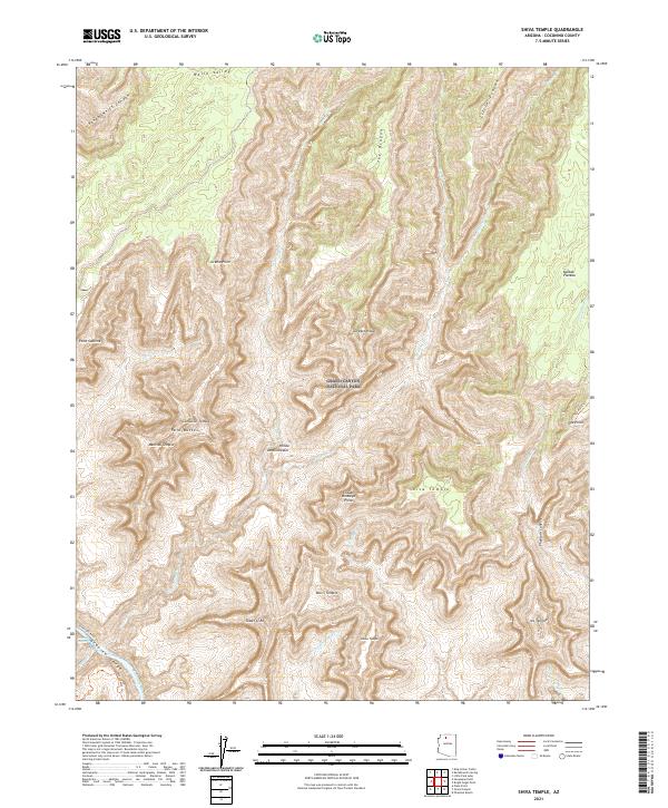
2021 Map of Shiva Temple
USGS Topo · Published 2021About this map
Grand Canyon National Park reveals its complex topography in this high-resolution study centered on the monumental Shiva Temple. The land is defined by colossal erosional features named for global deities and philosophers, including Confucius Temple, Mencius Temple, and the Hindu Amphitheater. This nomenclature, established during early geological surveys, reflects the late 19th-century intellectual fascination with ancient world history and mythology. Along the southern edge of the quadrangle, the Colorado River carves through the Granite Gorge, where the West Tonto Trl traverses the inner canyon. Key drainages such as Crystal Cr and Dragon Cr feed the river, while prominent landmarks like Point Sublime and Claude Birdseye Point provide critical vantage points over the massive drainage systems of Phantom Canyon and Kanabownits Canyon.
Find a feature on this map
41 named features on this map. Tap any name to fly to it.
Don’t see what you’re looking for? This feature index may not catch every label — zoom into the map to look around manually.
Map Details
Editions of this 2021 Shiva Temple Map
This is the sole edition of this map. No revisions or reprints were ever made.
Other maps of this area

1886 · Kaibab
USGS Topo · 1:250,000

1903 · Bright Angel
USGS Topo · 1:48,000

1906 · Bright Angel
USGS Topo · 1:48,000

1953 · Grand Canyon
USGS Topo · 1:250,000

1957 · Grand Canyon
USGS Topo · 1:250,000

1958 · Grand Canyon
USGS Topo · 1:250,000

1960 · Grand Canyon
USGS Topo · 1:250,000

1962 · Bright Angel
USGS Topo · 1:48,000

1962 · De Motte Park
USGS Topo · 1:62,500

1962 · Havasupai Point
USGS Topo · 1:62,500