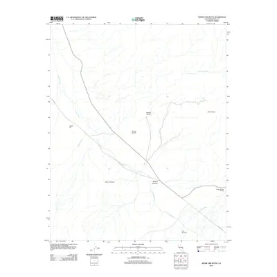
2012 Map of Shore Line Butte
USGS Topo · Published 2012About this map
Ashford Junction serves as a critical point of orientation in this arid landscape where the Amargosa River winds through the southern reaches of Death Valley National Park. The topography is defined by significant elevations and drainage systems, including the prominent Ashford Peak and the geological formation at Shore Line Butte. Water sources are sparse but notable, with Scottys Spring and Timpapah Spring appearing as vital landmarks in the desert terrain. The drainage patterns are clearly etched into the earth through Wingate Wash, Jubilee Wash, and The Narrows, illustrating how flash floods and seasonal flows have sculpted the environment. These features, along with the volcanic presence of Cinder Hill, reveal a complex geological history preserved in this 2012 survey.
Find a feature on this map
16 named features on this map. Tap any name to fly to it.
Don’t see what you’re looking for? This feature index may not catch every label — zoom into the map to look around manually.
Map Details
Editions of this 2012 Shore Line Butte Map
This is the sole edition of this map. No revisions or reprints were ever made.
Other maps of this area

1908 · Furnace Creek
USGS Topo · 1:250,000

1910 · Furnace Creek
USGS Topo · 1:250,000

1933 · Avawatz Mountains
USGS Topo · 1:250,000

1947 · Trona
USGS Topo · 1:250,000

1948 · Trona
USGS Topo · 1:250,000

1948 · Death Valley
USGS Topo · 1:250,000

1950 · Wingate Wash
USGS Topo · 1:62,500

1950 · Confidence Hills
USGS Topo · 1:62,500

1951 · Funeral Peak
USGS Topo · 1:62,500

1952 · Bennetts Well
USGS Topo · 1:62,500