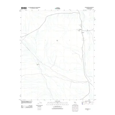
2012 Map of Shoshone
USGS Topo · Published 2012About this map
Shoshone stands as a vital desert outpost in this 2012 survey, defined by its relationship with the ephemeral Amargosa River and the critical water source at Shoshone Spring. The landscape reveals a complex network of geological and historical features, from the dramatic Dublin Hills to the uniquely named Castle in Clay landform. Modern infrastructure like the Shoshone Airport and Old State Hwy 127 connects this remote corner of Inyo County to the wider Mojave. The map detail highlights how the terrain of Greenwater Valley and Dublin Gulch shapes the path of desert travel along routes like Furnace Creek Wash Rd, illustrating the persistence of this small community in a demanding environment.
Find a feature on this map
11 named features on this map. Tap any name to fly to it.
Don’t see what you’re looking for? This feature index may not catch every label — zoom into the map to look around manually.
Map Details
Editions of this 2012 Shoshone Map
This is the sole edition of this map. No revisions or reprints were ever made.
Other maps of this area

1908 · Furnace Creek
USGS Topo · 1:250,000

1910 · Furnace Creek
USGS Topo · 1:250,000

1933 · Avawatz Mountains
USGS Topo · 1:250,000

1940 · Eagle Tank
USGS Topo · 1:62,500

1947 · Trona
USGS Topo · 1:250,000

1948 · Trona
USGS Topo · 1:250,000

1948 · Death Valley
USGS Topo · 1:250,000

1950 · Tecopa
USGS Topo · 1:62,500

1951 · Tecopa
USGS Topo · 1:62,500

1951 · Eagle Mtn
USGS Topo · 1:62,500