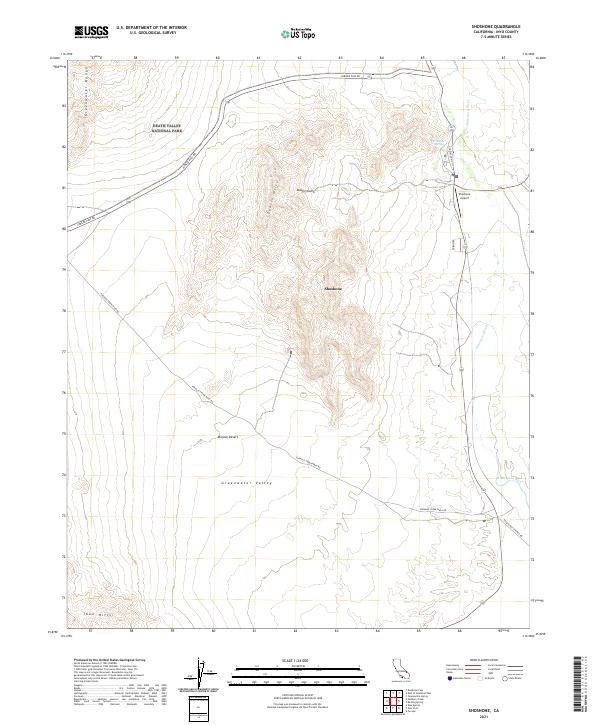
2021 Map of Shoshone
USGS Topo · Published 2021About this map
Shoshone serves as a vital desert gateway at the eastern edge of Death Valley National Park. This 2021 survey details the convergence of essential desert travel routes, including Jubilee Pass Rd and Furnace Creek Wash Rd, which navigate the complex terrain of the Dublin Hills and the Greenwater Range. The hydrological importance of the area is highlighted by the Amargosa Wild and Scenic River and the nearby Shoshone Spring, which provide critical water sources in the arid Mojave Desert. Local infrastructure, such as the Shoshone Airport and Old State Hwy 127, reflects the area's role as a transit hub between the Greenwater Valley and the Ibex Hills. The map clearly delineates the park boundaries and public land survey systems, illustrating the modern management of this historical landscape.
Find a feature on this map
21 named features on this map. Tap any name to fly to it.
Don’t see what you’re looking for? This feature index may not catch every label — zoom into the map to look around manually.
Map Details
Editions of this 2021 Shoshone Map
This is the sole edition of this map. No revisions or reprints were ever made.
Other maps of this area

1908 · Furnace Creek
USGS Topo · 1:250,000

1910 · Furnace Creek
USGS Topo · 1:250,000

1933 · Avawatz Mountains
USGS Topo · 1:250,000

1940 · Eagle Tank
USGS Topo · 1:62,500

1947 · Trona
USGS Topo · 1:250,000

1948 · Trona
USGS Topo · 1:250,000

1948 · Death Valley
USGS Topo · 1:250,000

1950 · Tecopa
USGS Topo · 1:62,500

1951 · Tecopa
USGS Topo · 1:62,500

1951 · Eagle Mtn
USGS Topo · 1:62,500