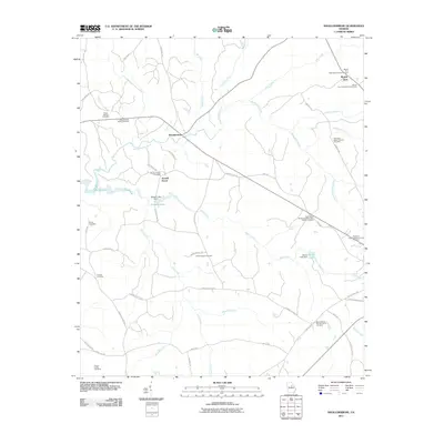
2011 Map of Shoulderbone
USGS Topo · Published 2011About this map
Shoulderbone sits at a geographic crossroads in rural Georgia, where the waters of Shoulderbone Creek and Fort Creek carve through the landscape. This early 21st-century record reveals a region deeply tied to its generational roots, evidenced by the numerous family burial grounds scattered across the terrain. These sites, such as the Green-Hudson Family Cemetery and the Mosley Family Cemetery, provide significant data for genealogical research, anchoring specific families to land near Howell Grove and the northern reaches of Lake Sinclair.
Find a feature on this map
59 named features on this map. Tap any name to fly to it.
Don’t see what you’re looking for? This feature index may not catch every label — zoom into the map to look around manually.
Map Details
Editions of this 2011 Shoulderbone Map
This is the sole edition of this map. No revisions or reprints were ever made.
Other maps of this area

1912 · Milledgeville
USGS Topo · 1:62,500

1953 · Athens
USGS Topo · 1:250,000

1958 · Athens
USGS Topo · 1:250,000

1959 · Athens
USGS Topo · 1:250,000

1961 · Warthen NW
USGS Topo · 1:24,000

1963 · Athens
USGS Topo · 1:250,000

1972 · Liberty
USGS Topo · 1:24,000

1972 · Shoulderbone
USGS Topo · 1:24,000

1972 · Sparta NW
USGS Topo · 1:24,000
1972 · Devereux
USGS Topo · 1:24,000