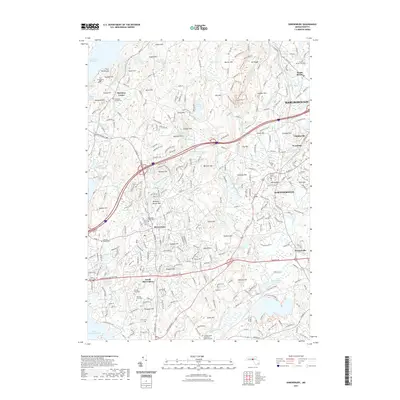
2021 Map of Shrewsbury
USGS Topo · Published 2021About this map
Shrewsbury sits at the heart of this Worcester County landscape, characterized by a series of prominent drumlins and ridges like Green Hill and Prospect Hill. The region's hydrological complexity is evident in the sprawling Wachusett Reservoir to the northwest and the winding course of the Assabet River, which feeds into the Northborough Reservoir. These water systems, alongside smaller bodies like Lake Quinsigamond and Rocky Pond, historically shaped the development of settlements such as Northborough, Marlborough, and Boylston Center. Transport corridors, including the CSX rail line and major thoroughfares like the Turnpike Rd, cut through the terrain, illustrating the area's role as a vital connector. Local heritage is preserved in numerous burial sites, including the Old Burial Ground Cem and the Grafton State Hospital Memorial Cem, which offer significant touchpoints for genealogical research and local history studies in these long-established Massachusetts towns.
Find a feature on this map
297 named features on this map. Tap any name to fly to it.
Don’t see what you’re looking for? This feature index may not catch every label — zoom into the map to look around manually.
Map Details
Editions of this 2021 Shrewsbury Map
This is the sole edition of this map. No revisions or reprints were ever made.
Other maps of this area

1885 · Worcester
USGS Topo · 1:62,500

1886 · Worcester
USGS Topo · 1:62,500

1886 · Blackstone
USGS Topo · 1:62,500

1887 · Marlboro
USGS Topo · 1:62,500

1889 · Marlboro
USGS Topo · 1:62,500

1889 · Blackstone
USGS Topo · 1:62,500

1889 · Webster
USGS Topo · 1:62,500

1892 · Webster
USGS Topo · 1:62,500

1892 · Worcester
USGS Topo · 1:62,500

1893 · Blackstone
USGS Topo · 1:62,500