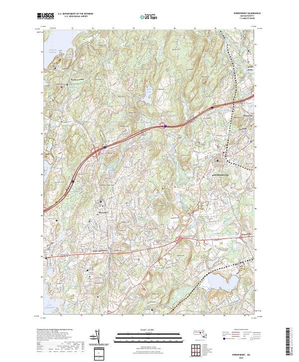
2024 Map of Shrewsbury
USGS Topo · Published 2024About this map
Boylston Center and Shrewsbury anchor this survey of the Worcester hills, where historical cemeteries and modern infrastructure converge. The landscape is defined by its water systems, from the expansive Wachusett Reservoir in the northwest to the Assabet River drainage in the east. Local history is deeply rooted here, visible in sites like the Old Burial Ground Cem and Meeting House Hall. Significant topography including Mt Pisgah and Ball Hill rises above a network of secondary roads and major arteries like I-290 and the Boston Tpke. The map provides detailed placement of numerous family and municipal burial sites, such as the Johnson Family Cem and Saint Anne's Cem, which offer specific locations for genealogical research. Institutional footprints like the Grafton State Hospital and Shrewsbury High Sch show the community's development amidst a complex hydrography of ponds and brooks.
Find a feature on this map
92 named features on this map. Tap any name to fly to it.
Don’t see what you’re looking for? This feature index may not catch every label — zoom into the map to look around manually.
Map Details
Editions of this 2024 Shrewsbury Map
This is the sole edition of this map. No revisions or reprints were ever made.
Other maps of this area

1885 · Worcester
USGS Topo · 1:62,500

1886 · Worcester
USGS Topo · 1:62,500

1886 · Blackstone
USGS Topo · 1:62,500

1887 · Marlboro
USGS Topo · 1:62,500

1889 · Marlboro
USGS Topo · 1:62,500

1889 · Blackstone
USGS Topo · 1:62,500

1889 · Webster
USGS Topo · 1:62,500

1892 · Webster
USGS Topo · 1:62,500

1892 · Worcester
USGS Topo · 1:62,500

1893 · Blackstone
USGS Topo · 1:62,500