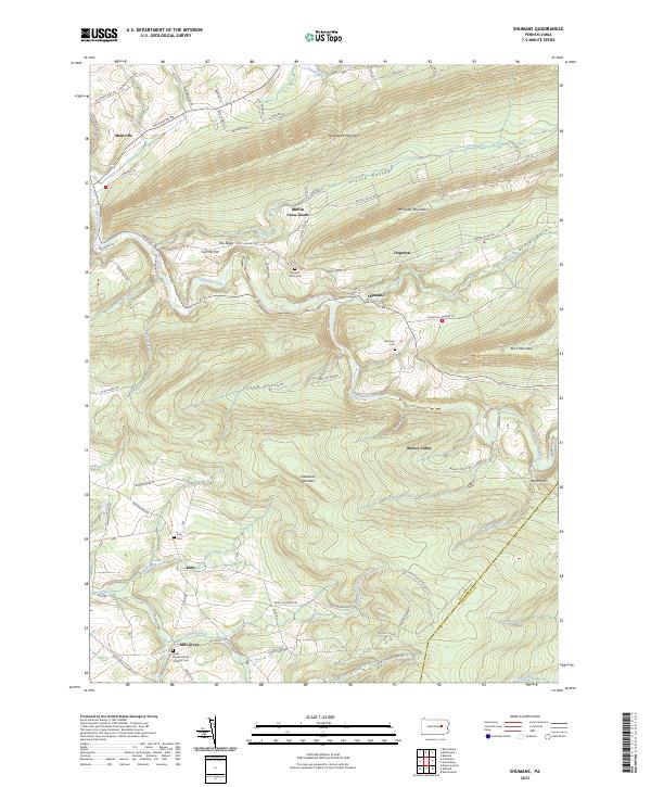
2023 Map of Shumans
USGS Topo · Published 2023About this map
Catawissa Creek carves a deep path through the ridges of central Pennsylvania, shaping the development of settlements like Shumans and Mainville. This part of Columbia County is defined by a series of parallel heights, including Nescopeck Mountain, McCauley Mountain, and Catawissa Mountain, which confine early road networks and rural clusters to narrow valleys and hollows. The map shows a clear pattern of small, dispersed communities such as Mifflin Cross Roads and Mill Grove, often anchored by family and community landmarks like Hargers Union Cem and Grace United Church of Christ Cem. The presence of features like Full Mill Hill and various gap runs suggests the region's reliance on the local topography for early industry and transit. Long-established names such as Kulp and Dogtown reflect a landscape that has maintained its rural character and genealogical heritage well into the twenty-first century.
Find a feature on this map
84 named features on this map. Tap any name to fly to it.
Don’t see what you’re looking for? This feature index may not catch every label — zoom into the map to look around manually.
Map Details
Editions of this 2023 Shumans Map
This is the sole edition of this map. No revisions or reprints were ever made.
Other maps of this area

1889 · Catawissa
USGS Topo · 1:62,500

1892 · Catawissa
USGS Topo · 1:62,500

1892 · Mahanoy
USGS Topo · 1:62,500

1893 · Mahanoy
USGS Topo · 1:62,500

1894 · Catawissa
USGS Topo · 1:62,500

1894 · Shickshinny
USGS Topo · 1:62,500

1894 · Bloomsburg
USGS Topo · 1:62,500

1946 · Berwick
USGS Topo · 1:31,680

1947 · Bloomsburg
USGS Topo · 1:24,000

1947 · Ashland
USGS Topo · 1:24,000