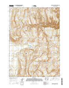
2014 Map of Shumway Reservoir
USGS Topo · Published 2014About this map
Levanger and Creston appear as primary markers of settlement in this arid section of Malheur County, where the management of water is the defining characteristic of the landscape. The region is heavily shaped by an intricate network of man-made catchments, including Shumway Reservoir, Arrien Reservoir, and Box Spring Reservoir, reflecting the essential infrastructure required for ranching in eastern Oregon. Numerous springs, such as Fenton Spring and McConnell Springs, dot the terrain, providing vital water sources between the higher elevations of Lake Ridge and Monument Rock. The road network, including Shumway Ranch Rd and Shumway Cutoff Rd, underscores the area's agricultural focus, connecting various reservoirs and springs across the high desert topography. This survey captures the critical intersection of natural hydrology and human intervention in a remote ranching territory.
Find a feature on this map
43 named features on this map. Tap any name to fly to it.
Don’t see what you’re looking for? This feature index may not catch every label — zoom into the map to look around manually.
Map Details
Editions of this 2014 Shumway Reservoir Map
This is the sole edition of this map. No revisions or reprints were ever made.
Other maps of this area

1955 · Burns
USGS Topo · 1:250,000

1955 · Boise
USGS Topo · 1:250,000

1958 · Burns
USGS Topo · 1:250,000

1958 · Boise
USGS Topo · 1:250,000

1959 · Burns
USGS Topo · 1:250,000

1962 · Boise
USGS Topo · 1:250,000

1972 · Tims Peak
USGS Topo · 1:24,000

1972 · Shumway Reservoir
USGS Topo · 1:24,000

1972 · Alder Creek
USGS Topo · 1:24,000
1972 · Skull Springs
USGS Topo · 1:24,000