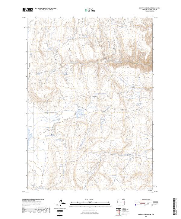
2023 Map of Shumway Reservoir
USGS Topo · Published 2023About this map
High desert water management defines this portion of Malheur County, where a complex network of small reservoirs and named springs supports livestock and wildlife in a demanding landscape. Shumway Reservoir sits centrally, reached by the Shumway Ranch Rd and the Shumway Cutoff Rd. The topography is marked by significant drainages such as Cottonwood Creek and Granite Creek, which channel seasonal runoff between elevated features like Lake Ridge and Spear Head Reservoir. The small settlement at Creston and the Sexton Reservoir anchored the southern reaches of this survey. Numerous family-named or descriptive water sources, including Arrien Reservoir and Brass Cap Reservoir, illustrate the historical necessity of capturing every available spring and creek flow to sustain ranching operations across these basins.
Find a feature on this map
38 named features on this map. Tap any name to fly to it.
Don’t see what you’re looking for? This feature index may not catch every label — zoom into the map to look around manually.
Map Details
Editions of this 2023 Shumway Reservoir Map
This is the sole edition of this map. No revisions or reprints were ever made.
Other maps of this area

1955 · Burns
USGS Topo · 1:250,000

1955 · Boise
USGS Topo · 1:250,000

1958 · Burns
USGS Topo · 1:250,000

1958 · Boise
USGS Topo · 1:250,000

1959 · Burns
USGS Topo · 1:250,000

1962 · Boise
USGS Topo · 1:250,000

1972 · Tims Peak
USGS Topo · 1:24,000

1972 · Shumway Reservoir
USGS Topo · 1:24,000

1972 · Alder Creek
USGS Topo · 1:24,000
1972 · Skull Springs
USGS Topo · 1:24,000