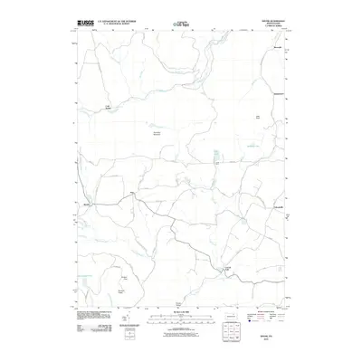
2010 Map of Shunk
USGS Topo · Published 2010About this map
Schrader Creek and its many tributaries, including Rollinson Run and Cabin Run, carve through this section of Bradford County, defining a landscape of isolated settlements and narrow hollows. Small hamlets like Minerville, Quinlantown, and Shunk are connected by a network of winding mountain roads such as Lazytown and Picnic Rd. The area is notably water-rich, featuring several named falls like Buttermilk Falls and the community of Lincoln Falls, where the landscape drops away into deeper valleys. High points such as Roundtop Mountain and Lake Knob overlook recreational and local landmarks including Camp Brule and Williams Lake. This survey illustrates the persistent rural character of the region, where family names are often preserved in features like Browns Ridge and Painter Hollow.
Find a feature on this map
59 named features on this map. Tap any name to fly to it.
Don’t see what you’re looking for? This feature index may not catch every label — zoom into the map to look around manually.
Map Details
Editions of this 2010 Shunk Map
This is the sole edition of this map. No revisions or reprints were ever made.
Other maps of this area

1927 · Eagles Mere
USGS Topo · 1:48,000

1930 · Warrensville
USGS Topo · 1:62,500

1932 · Eagle Mere
USGS Topo · 1:62,500

1934 · Warrensville
USGS Topo · 1:62,500

1942 · Canton
USGS Topo · 1:62,500

1943 · Powell
USGS Topo · 1:62,500

1944 · Canton
USGS Topo · 1:62,500

1945 · Powell
USGS Topo · 1:62,500

1953 · Warrensville
USGS Topo · 1:62,500

1953 · Eagles Mere
USGS Topo · 1:62,500
Featured Places
- Leroy Township, PA
- Overton Township, PA
- Elkland Township, PA
- Lincoln Falls, Elkland Township
- Minerville, Overton Township