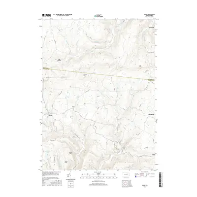
2016 Map of Shunk
USGS Topo · Published 2016About this map
Shunk and Lincoln Falls anchor the southern reaches of this landscape, where the border between Bradford and Sullivan counties cuts across high terrain. This area is defined by its watercourses, from the steep descent of Buttermilk Falls to the drainage of Schrader Cr and Elk Cr. The settlement pattern reflects isolated rural communities such as Quinlantown, Minerville, and Eldredsville, many connected by secondary routes like sr4006 and sr4008.
Find a feature on this map
86 named features on this map. Tap any name to fly to it.
Don’t see what you’re looking for? This feature index may not catch every label — zoom into the map to look around manually.
Map Details
Editions of this 2016 Shunk Map
This is the sole edition of this map. No revisions or reprints were ever made.
Other maps of this area

1927 · Eagles Mere
USGS Topo · 1:48,000

1930 · Warrensville
USGS Topo · 1:62,500

1932 · Eagle Mere
USGS Topo · 1:62,500

1934 · Warrensville
USGS Topo · 1:62,500

1942 · Canton
USGS Topo · 1:62,500

1943 · Powell
USGS Topo · 1:62,500

1944 · Canton
USGS Topo · 1:62,500

1945 · Powell
USGS Topo · 1:62,500

1953 · Warrensville
USGS Topo · 1:62,500

1953 · Eagles Mere
USGS Topo · 1:62,500
Featured Places
- Leroy Township, PA
- Overton Township, PA
- Elkland Township, PA
- Lincoln Falls, Elkland Township
- Minerville, Overton Township