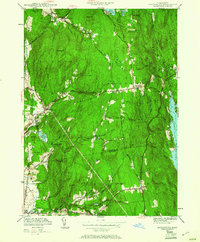
1950 Map of Shutesbury
USGS Topo · Published 1961About this map
The eastern shoreline of the Quabbin Reservoir dominates the landscape of this 1950 revision, marking a definitive shift in the region's geography following the reservoir's creation. The map details the central hilltop village of Shutesbury and the higher elevations of Pelham, including the Rhodes Sch and the community around Pelham Hill Road. While the reservoir reshaped the eastern boundary, the interior maintains a network of older settlements such as Cooleyville, Dudleyville, and Baconville. Small-scale water management is evident through features like Atkins Reservoir, Baker Reservoir, and Lake Wyola in the north. The terrain is defined by prominent peaks including Brushy Mtn, Mt Orient, and the curiously named Poverty Mtn. Local history is preserved in the location of the West Cem and Valley Cem, alongside landmarks like Orient Springs, reflecting a period when these rural Franklin and Hampshire County townships balanced conservation with their agricultural and residential roots.
Find a feature on this map
53 named features on this map. Tap any name to fly to it.
Don’t see what you’re looking for? This feature index may not catch every label — zoom into the map to look around manually.
Map Details
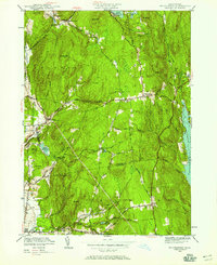
Editions of this 1950 Shutesbury Map
2 editions found
Other maps of this area

1885 · Northampton
USGS Topo · 1:62,500

1886 · Northampton
USGS Topo · 1:62,500

1887 · Warwick
USGS Topo · 1:62,500

1887 · Belchertown
USGS Topo · 1:62,500

1889 · Warwick
USGS Topo · 1:62,500

1890 · Belchertown
USGS Topo · 1:62,500

1890 · Greenfield
USGS Topo · 1:62,500

1891 · Northampton
USGS Topo · 1:62,500

1893 · Northampton
USGS Topo · 1:62,500

1893 · Belchertown
USGS Topo · 1:62,500