2024 Map of Siasconset
USGS Topo · Published 2024About this map
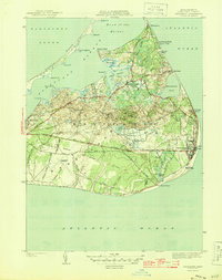
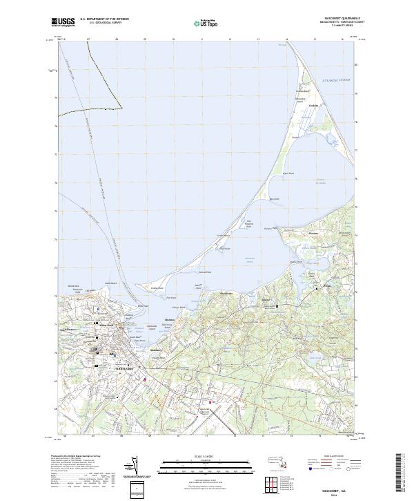
Nantucket serves as the focal point of this coastal survey, where dense residential streets and historic civic structures like the Nantucket County Superior Courthouse meet the protective curve of Nantucket Harbor. The map reveals a complex funerary landscape, documenting numerous burial sites including the Old North Cem, New North Cem, and the Miacomet Indian Burial Ground. Further east, the island's maritime character is defined by the long, slender arm of Coatue and the remote reaches of Coskata Beach, protecting the inner harbors of Polpis Harbor and Shimmo Creek.
Find a feature on this map
192 named features on this map. Tap any name to fly to it.
Don’t see what you’re looking for? This feature index may not catch every label — zoom into the map to look around manually.
Map Details
Editions of this 2024 Siasconset Map
This is the sole edition of this map. No revisions or reprints were ever made.
Historical Maps of Quaise Through Time
7 maps found