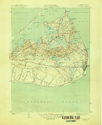
1945 Map of Siasconset
USGS Topo · Published 1945About this map
Siasconset and the eastern reaches of Nantucket are captured here during the mid-1940s, revealing a landscape defined by its maritime isolation and transition from rail to road. The interior is marked by the Abandoned Railroad Grade, a relic of the island's earlier narrow-gauge rail era, now superseded by thoroughfares like Milestone Road. Along the Atlantic shore, the coastal village of Codfish Park sits below the heights of Sankaty Head, while the interior moors rise to high points at Altar Rock and Folger Hill. To the north, the complex geography of Nantucket Harbor is shaped by the long arm of Coatue Beach and the distinct peninsulas of Pocomo and Quaise. The map details the early footprint of the Nantucket Airport and traditional seasonal settlements like Wauwinet and Quidnet, illustrating the island's character before extensive modern development.
Find a feature on this map
64 named features on this map. Tap any name to fly to it.
Don’t see what you’re looking for? This feature index may not catch every label — zoom into the map to look around manually.
Map Details
Editions of this 1945 Siasconset Map
2 editions found
Other maps of this area

1889 · Nantucket
USGS Topo · 1:62,500

1893 · Nantucket
USGS Topo · 1:62,500

1901 · Nantucket
USGS Topo · 1:62,500

1942 · Nantucket
USGS Topo · 1:125,000

1945 · Nantucket
USGS Topo · 1:31,680

1945 · Siasconset
USGS Topo · 1:31,680

1945 · Great Point
USGS Topo · 1:31,680

1947 · Providence
USGS Topo · 1:250,000

1948 · Providence
USGS Topo · 1:250,000

1951 · Great Point
USGS Topo · 1:31,680