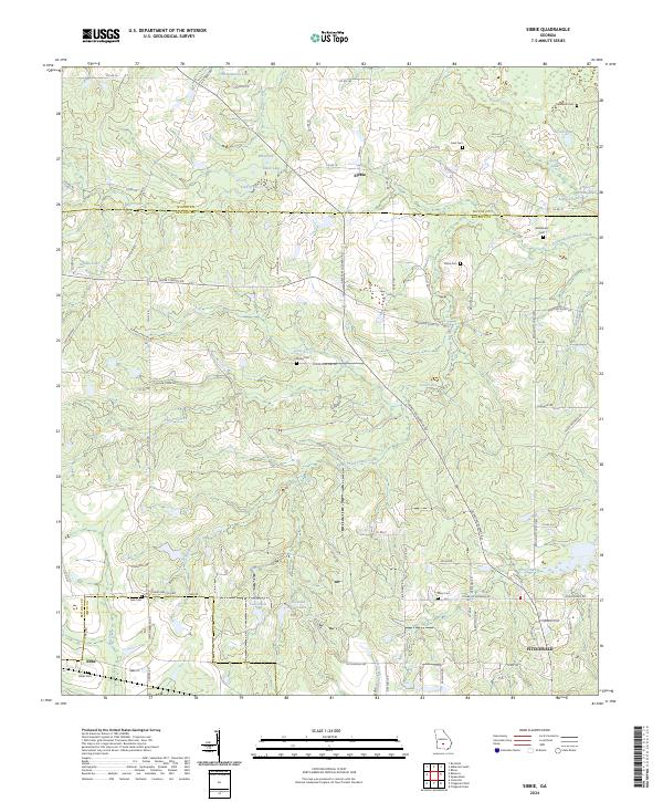
2024 Map of Sibbie
USGS Topo · Published 2024About this map
Sibbie and the northern outskirts of Fitzgerald anchor this South Georgia landscape at the border of Wilcox and Ben Hill counties. The area is characterized by a dense network of water features and depressions, including Blue Sink, Black Lake, and the uniquely named Devils Den. This terrain is a complex hydrologic system where small streams like Ball Creek and Stone Creek navigate through numerous sinks and ponds, such as the Sink of the Cr and Ocean Pond.
Find a feature on this map
93 named features on this map. Tap any name to fly to it.
Don’t see what you’re looking for? This feature index may not catch every label — zoom into the map to look around manually.
Map Details
Editions of this 2024 Sibbie Map
This is the sole edition of this map. No revisions or reprints were ever made.
Other maps of this area

1953 · Waycross
USGS Topo · 1:250,000

1958 · Waycross
USGS Topo · 1:250,000

1972 · Fitzgerald East
USGS Topo · 1:24,000

1972 · Queensland
USGS Topo · 1:24,000

1973 · Irwinville
USGS Topo · 1:24,000

1973 · Fitzgerald West
USGS Topo · 1:24,000

1974 · Rebecca
USGS Topo · 1:24,000
1974 · Abbeville South
USGS Topo · 1:24,000
1977 · Queensland
USGS Topo · 1:24,000
1977 · Rochelle
USGS Topo · 1:24,000