
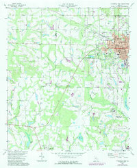
1973 Map of Fitzgerald West
USGS Topo · Published 1976About this map
The city of Fitzgerald serves as the focal point of this 1970s survey, showing a well-developed grid of schools, churches, and civic institutions. Notable landmarks within the city include Dorminy Memorial Hospital, Blue and Gray Park, and several specialized schools like Magnolia Jr High Sch. The Seaboard Coast Line Railroad and a network of secondary roads connect the urban center to rural communities like Westwood and Mystic.
Find a feature on this map
50 named features on this map. Tap any name to fly to it.
Don’t see what you’re looking for? This feature index may not catch every label — zoom into the map to look around manually.
Map Details
Editions of this 1973 Fitzgerald West Map
2 editions found
Other maps of this area

1953 · Waycross
USGS Topo · 1:250,000

1958 · Waycross
USGS Topo · 1:250,000

1972 · Fitzgerald East
USGS Topo · 1:24,000

1972 · Ocilla East
USGS Topo · 1:24,000

1972 · Queensland
USGS Topo · 1:24,000

1973 · Ocilla West
USGS Topo · 1:24,000

1973 · Waterloo
USGS Topo · 1:24,000

1973 · Irwinville
USGS Topo · 1:24,000

1974 · Rebecca
USGS Topo · 1:24,000
1977 · Queensland
USGS Topo · 1:24,000