
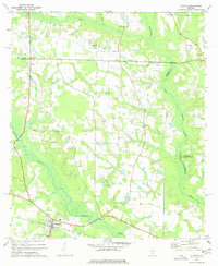
1972 Map of Ocilla East
USGS Topo · Published 1977About this map
Ocilla anchors the northwestern corner of this South Georgia landscape, where agricultural fields and timberlands meet the winding corridors of the Willacoochee River and Brushy Creek. The 1970s survey captures the town's essential infrastructure, including the Filtration Plant, a Water Tank, and local recreation at Cumbee Park.
Find a feature on this map
25 named features on this map. Tap any name to fly to it.
Don’t see what you’re looking for? This feature index may not catch every label — zoom into the map to look around manually.
Map Details
Editions of this 1972 Ocilla East Map
This is the sole edition of this map. No revisions or reprints were ever made.
Other maps of this area

1953 · Waycross
USGS Topo · 1:250,000

1958 · Waycross
USGS Topo · 1:250,000

1972 · Fitzgerald East
USGS Topo · 1:24,000

1972 · Lax
USGS Topo · 1:24,000

1972 · Ambrose
USGS Topo · 1:24,000

1973 · Ocilla West
USGS Topo · 1:24,000

1973 · Enigma
USGS Topo · 1:24,000

1973 · Fitzgerald West
USGS Topo · 1:24,000

1977 · Osierfield
USGS Topo · 1:24,000
1977 · Alapaha
USGS Topo · 1:24,000